As we walked northwards out of the Pine River valley this morning, it struck me how the face of the Trail has fundamentally changed since we entered the Orangeville area. South of Caledon, the native and often bare rock of the escarpment controls the majority of what we were hiking on. The cracked structure of the dolostone was never far from the soles of our feet. There were often long stretches of blocky fissured rock that forced close attention to navigate. Pretty, and pretty challenging. Perhaps most notable was a section near Grimsby, but there were plenty of other kilometres like it.
Today we did 23 kilometres. There were several spots where perhaps a couple of hundred metres involved attentive pole work to scramble up and down gashes of rock that were exposed beneath the huge piles of glacial drift. But most of the walk was across rolling hills of what I presume is the Singhampton and Gibraltar Moraines. Yesterday and today, the map showed kilometer after kilometre of road walking. What most of it turned out to be was hard sandy Mulmur backroads carved straight out of sandy debris dropped as terminal and interlobate moraines by the retreating glaciers of 13,500 years ago as they melted away. One of the most striking such sections was several kilometres along the old Hurontario Street planned to be the military road from Lake Ontario to Georgian Bay. In several places the piles of rock along the side of the Hurontario Street were clearly boulders dragged out of the roadway to even the surface, instead of the far more common stone fences associated with field clearing. We travelled back and forth WHS (West of Hurontario Street) and EHS (East of Hurontario Street) as well as directly on Hurontario Street. (I live on the Second Line WHS farther south in Orangeville.) The highlight of this long and softly pleasant road walking was having a snack at the old narrow military bridge where Hurontario Street crosses a tributary of Blsck Bank Creek just above a pretty little waterfall.
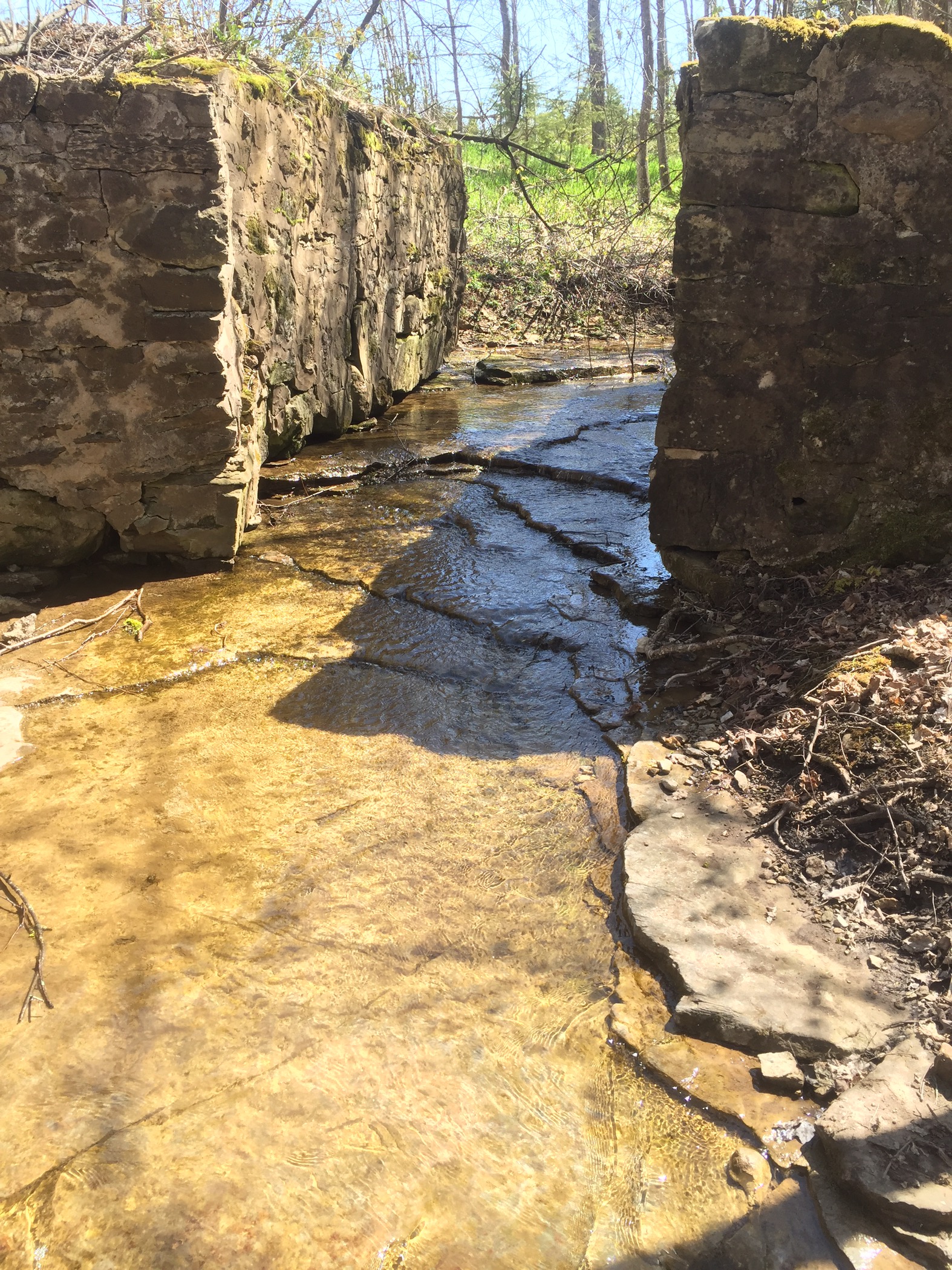
Abuttments of an old military bridge where Hurontario Street crosses a tributary of Black Bank Creek
It was here that we feasted on snacks from California. Anne, my knitting daughter, brought me back from California a large and rich selection of gorp ingredients, including the dried pears and sriracha coconut flakes that were the foundation of one of today’s snacks. My sister Margaret provided the other treat which was delectable salmon jerky also brought back from California.
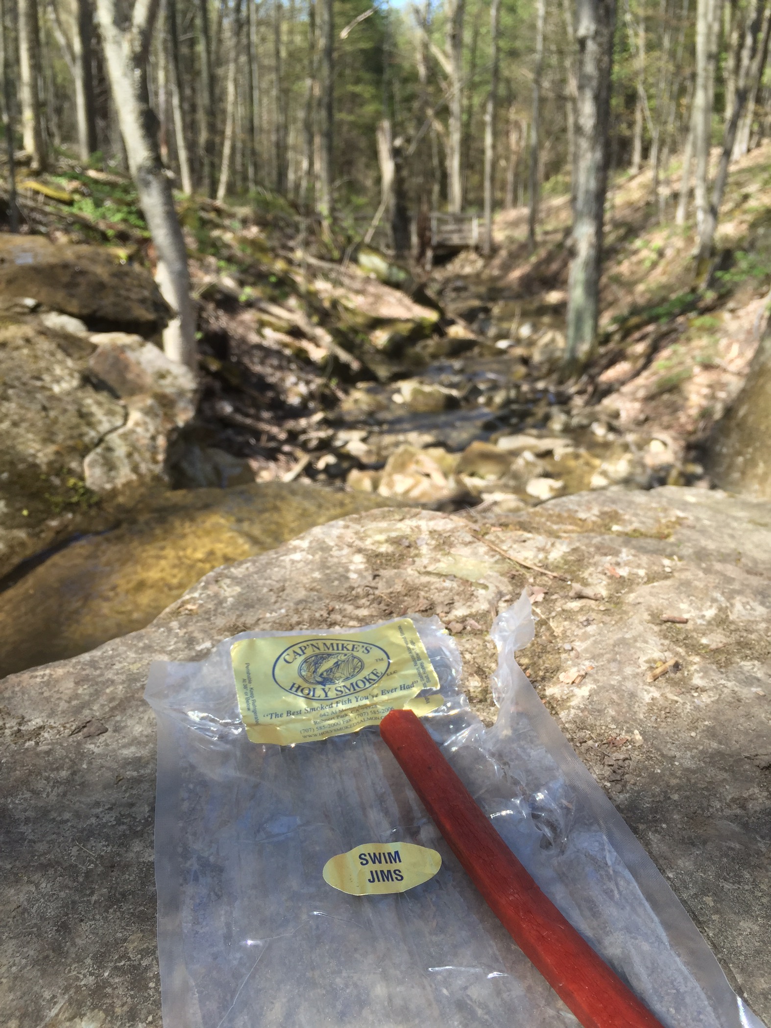
California meets Hurontario Street meets Black Bank Creek
Any excuse works for a trailside nap, and today’s nap featured the shade of the trees beside the Lavender Cemetery, complete with the constant joyous gurgling of bobolinks in the adjoining field.
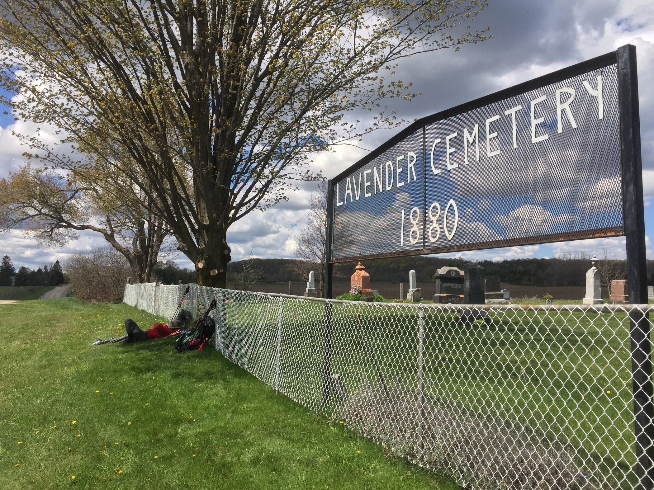
The living and the dead sleeping peacefully together
There were some gorgeous rocky sections as we wove our way westwards along the southern edge of the Noisy River. Perhaps the most striking of the crevices we’ve passed along the Trail ran parallel to the Trail. (Actually vice-versa, I suppose …)
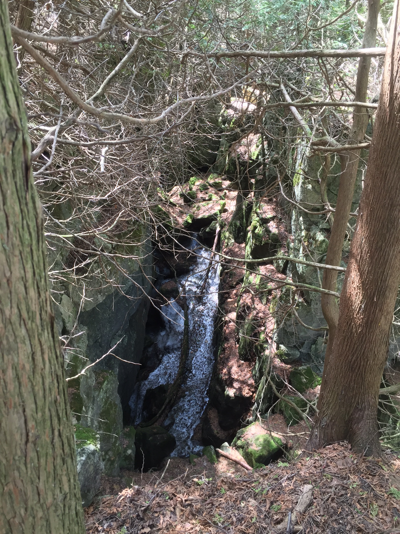
Snow at the bottom of a 20 metre crevice sbove the Noisy River Valley
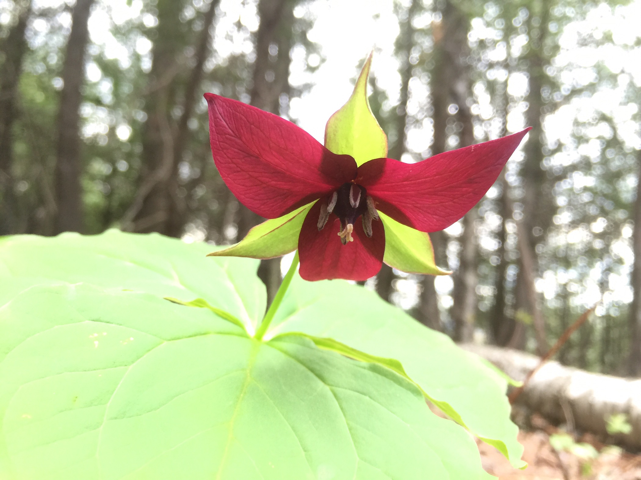
The day wouldn’t be complete without a Trillium, would it? Quite fully in bloom here, as opposed to being senescent further south …

Hotel Singhamton Sue is open for travellers! Would Chocolate chip brownies be an acceptable alternative to shortbread?? Looking forward to see you both!
See you soon!
Finally catching up with you and your blog Mark. Sounds like a wonderful adventure, and am looking forward to hearing more as you progress.
A wonderful and unexpectedly social adventure, Tom!